
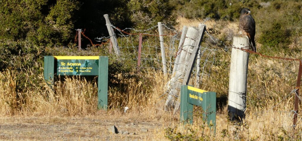
Te Araroa Information
Te Araroa – Richmond Ranges to Rakaia River
Te Araroa section guide: Walking times and trail nots for the Richmond Ranges to Rakaia River. This section guide covers Pelorus River, Nelson Lakes, and Arthurs Pass with itinerary ideas and key trail info.
Here is an overview of all sections in the Upper South Island, from the Pelorus River and Richmond Ranges to the Rakaia River, which will help you plan your food resupply parcels. Click here for more information on all TA drop points and estimated shipping fees.
Richmond ranges: 8-10 Days
Most people walk the Richmond Ranges in 8-10 days including the Pelorus River Track from Havelock to St Arnaud. There is the option to drop out after the Pelorus River Track at Hacket Junction and go to Hope or Nelson.
The weather in the Richmonds can be very unpredictable. It quickly can happen that you get stuck in a hut due to wind, rain and stormy weather. The section from Old Man Hut to Mt Rintoul Hut is especially exposed and rocky.
The official Trail Notes recommend: “Anyone attempting the Pelorus River Track and Richmond Alpine Track together as a single section should prepare for at least a 9-day tramp, the first 3 days would be on the Pelorus River Track.”
Times and Distances
Day 1: Havelock to Pelorus Bridge via Daltons Track – around 20km
Day 2: Road End to Captain Creek Hut – 8.5km / 4 hour + Captain Creek Hut to Middy Hut – 5km / 2 hour
Day 3: Middy Hut to Rocks Hut – 5km / 3 hour + Rocks Hut to Browning Hut – 11km / 4½ hour
Day 4: Browning Hut to Hacket Hut- 4.7km / 1.5 hour + Hacket Hut to Starveall Hut – 6km / 4 hours
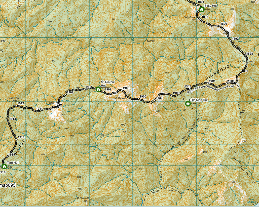
Day 5: Starveall Hut to Slaty Hut – 5km / 2.5 hours + Slaty Hut to Old Man Hut – 10km / 5 hours
Day 6: Old Man Hut to Rintoul Hut – 4.5km / 5 hours + Rintoul Hut to Tarn Hut – 8km / 4.5 hours
Day 7: Tarn Hut to Mid Wairoa Hut – 6.5km / 4 hours + Mid Wairoa Hut to Top Wairoa Hut – 7km / 4.5 hours
Day 8: Top Wairoa Hut to Hunters Hut – 10.5km / 5 hours + Hunters Hut to Porters Creek Hut – 9km / 4 hours
Day 9: Porters Creek Hut to Red Hills Hut – 10.5km / 5 hours + Red Hills Hut to Tophouse Road via Maitland Ridge Track (official TA
Route) – 12km / 4-5 hours
Alternative: Take Red Hills Track to SH63 – 7km / 3 hours
From Tophouse Road it is 750m to SH63, then an 8km (2hr) walk on the road shoulder to St Arnaud.
This is only a suggestion. We recommend planning at least one buffer day to give room for bad weather or rest if you need it. It is a difficult section with long days of walking.
Waiau Pass/ Nelson Lakes: 5 Days
Waiau Pass is a big highlight for most TA walkers. The first section is through the beautiful Nelson Lakes National Park. All huts on the northern side of Waiau Pass are not included in the Trail or Back Country Hut Pass. However, if you are a pass holder you can camp next to the huts for free and get a 20% discount if you purchase hut tickets for $25/each per at the DOC visitor centre in St Arnaud before heading into the next section (only offered for the Trail Pass).
On the southern side of Waiau Pass, you will join onto the ST James Walkway. The huts on the southern side are all included in the Trail and Back Country Hut Pass. Both trails are well-known loops and can be busy in summer. Walking times, especially on the St James Walkway, might seem generous to a seasoned TA walker.
Times and Distances
Day 1: St Arnaud to Lakehead Hut – 9.5km / 2-3 hours + Lakehead Hut to John Tait Hut – 12km / 5 hours
Alternative: Take the water taxi across Lake Rotoiti and spend the night at Upper Travis Hut.
Day 2: John Tait Hut to Upper Travers Hut – 6km / 3 hours + Upper Travers Hut to West Sabine Hut – 8km / 6-8 hours
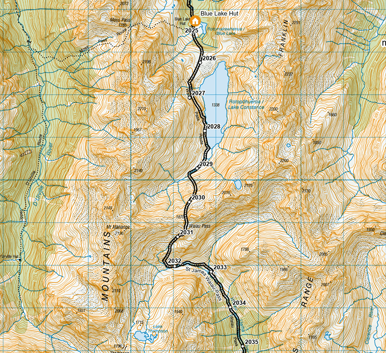
Keep pushing on to Blue Lake Hut if you have the time. It is beautiful to spend the night there.
Day 3: West Sabine Hut to Blue Lake Hut – 7km / 3 hours + Blue Lake Hut to Upper Waiau Forks – 7km / 6-8 hours
Day 4: Upper Waiau Forks to Waiau Hut – 8km / 4hr + Waiau Hut to Anne Hut – 26km / 7-8 hours
Day 5: Anne Hut to Boyle Flat Hut – 15km / 6 hours + Boyle Flat Hut to Boyle Village – 14.5km / 4 hours
This is only a suggestion. We recommend packing food for one more day to have some buffer.
Side trip: Add a detour to Angelus Hut (not included in Trail Pass – bookings are required, camping free with Back Country Hut Pass). You can take different tracks up to the hut. We recommend the Pinchgut Track/Robert Ridge Route. To loop back to the official TA trail, take the Cascade track down into the valley or have a look at the Sunset Saddle (this is not a marked route – there should be some stone cairns, but you need to be confident and able to navigate yourself).
Boyle River (Lewis Pass) to Arthurs Pass: 6 Days
This section is relatively straightforward. However, on the West Coast side of Harper Pass are a few river crossings that can only be attempted if rivers are low. The weather can change fast and the Taramakau and Otehake Rivers can quickly become impassable with much rain. As these crossings are a few days into the section, we recommend planning for some buffer and packing food for one or two more days to be safe.
This is even more relevant for the next part of the section: heading up the Deception River to Goat Pass Hut. The route involves many river crossings and is vulnerable to bad weather. Do not attempt it in heavy rain or when heavy rain is forecasted.
Times and Distances
Day 1: St James Car Park (Boyle Village) to Hope-Kiwi Lodge – 26.5km / 8 hours
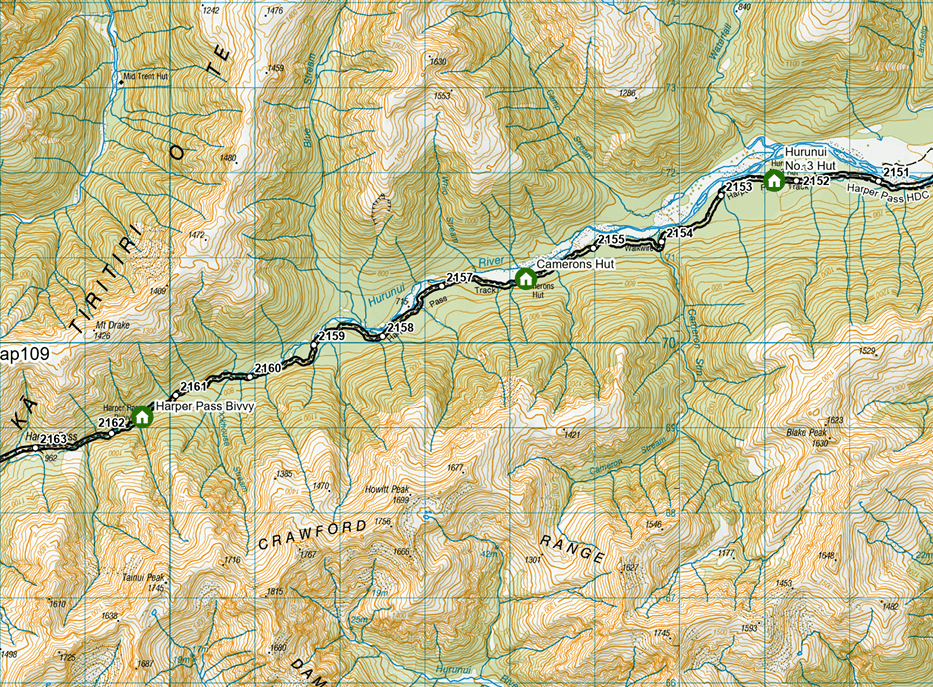
Day 2: Hope-Kiwi Lodge to Hurunui Hut – 19km / 6 hours + Hurunui Hut to Hurunui No.3 Hut – 10km / 4-5 hours
Day 3: Hurunui No.3 Hut to Locke Stream Hut — 15km / 7 hours
Day 4: Locke Stream Hut to Morrison footbridge (SH73)— 23km / 6-8 hours
If you want to head straight to Arthurs Pass, cross Morrison footbridge and hitchhike into the village.
Alternatively, cross the Otira River further up and save yourself around 1.5 hours of walking. You will come across a junction marked by a DOC sign just before km2185. Follow the markers to Aickens car park.
Day 5: Mingha – Deception Track: SH73 – Goat Pass Hut — 14.5km / 8-9 hours
Day 6: Goat Pass Hut to SH73 Bealey River — 9.5km / 5 hours
This is only a suggestion. We recommend packing food for one more day to have some buffer.
Arthurs Pass to Lake Coleridge/Rākaia River: 3 Days
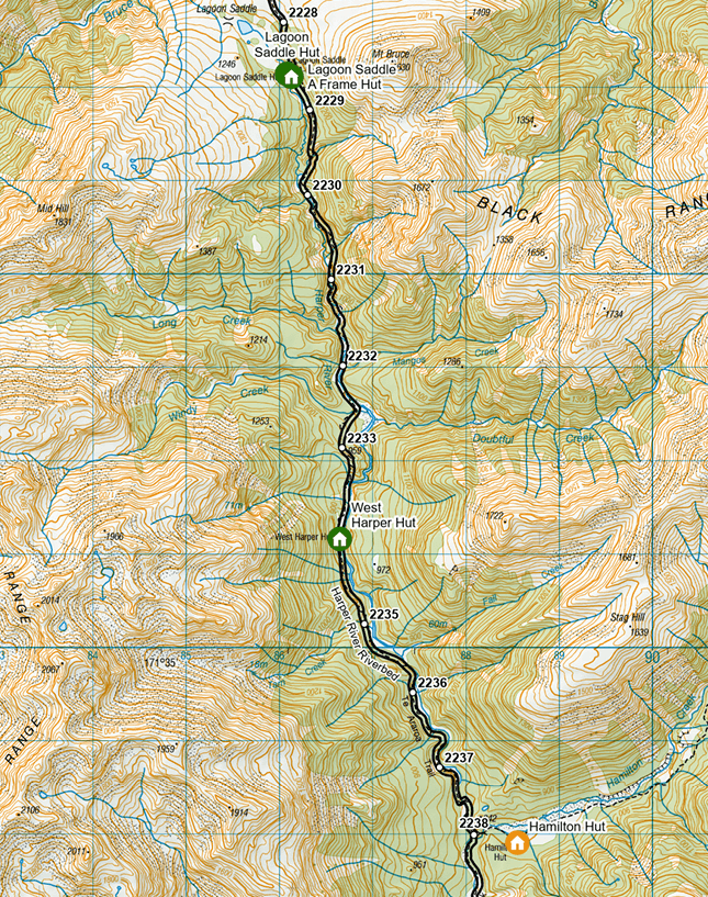
Day 1: Klondyke Track – 9km / 2-3hr + Harper River Track: Cora Lynn Carpark to Hamilton Hut – 15.5km / 7-8 hours
The Klondyke Track is a Te Araroa-specific link to reduce the road connection between the Deception-Mingha and Harper River Tracks.
Day 2: Hamilton Hut to Harper Rd – 18km / 5-6 hours
Day 3: Harper Village to the Homestead Road junction (24km) + Lake Hill Track to Coleridge Village – 3.5km / 1¼ hours
Note from the official Trail Notes: “It is 48km from Hamilton Hut to Lake Coleridge. There are NO places to camp between Harper Village and Lake Coleridge Village, so the recommended approach is to camp at the Harper Village campsite and then go from there to Lake Coleridge in a day – plan to reach Lake Coleridge before 5pm to maximise your chances of hitching a lift out to Rākaia Gorge/Methven.”
There now is an accommodation, the Powerhouse Lodge, where you can camp or stay in a dormitory at km 2286.1, just before Lake Coleridge Village. You also find the Lodge in our Drop Points.
For detailed information, trail descriptions, notes and maps, please visit the official Te Araroa website.